
footprint surveys
We measure, draft, model and deliver Geospatial confidence throughout the project lifecycle
footprint surveys
We measure, draft, model and deliver Geospatial confidence throughout the project lifecycle
Footprint Surveys has progressed with a team of professional and skilled experts, providing technical surveying services in the residential, commercial, heritage and private sectors.
We at footprint are committed to delivering our clients with accurate detailed surveys, by bringing the true surrounding environment to your desktop and ensuring our data provides a benchmark for your creative designs.
With our expert team, surveys ranging from small residential homes to large scale buildings are fully project managed and quality checked throughout the project lifecycle.
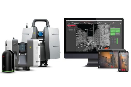
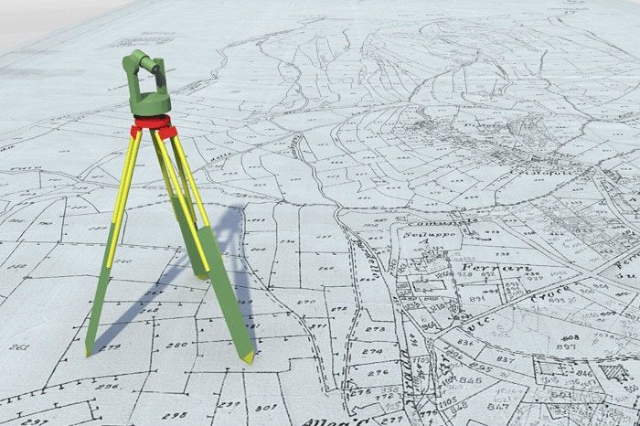
We utilise a range of techniques and latest surveying technology to ensure that every project is carried out with precision and accuracy.
By using a combination of reflector-less total stations, Disto's, laser scanners and electronic note pads, enables each project to be viewed and visually checked for assurance whilst on site.
Allowing Footprint Surveys to be market competitive.
3D Laser Scanning - Measured Building Surveys - Revit/Bim - Topographic Surveys - AutoCAD Drafting
Footprint Surveys specialise in land & measured building surveys throughout Kent, London, the South and the West of the UK.
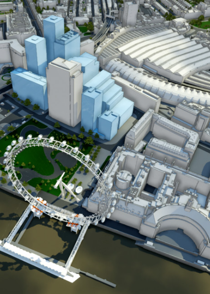
Laser scanning is transforming the way we collect data, enabling huge amounts of information to be gathered in the fastest and safest methods. The latest Modelling software enables designers and architects to visualise and build projects in a virtual reality, the accuracy of which is key to ensuring a fully cost effective and achievable project.
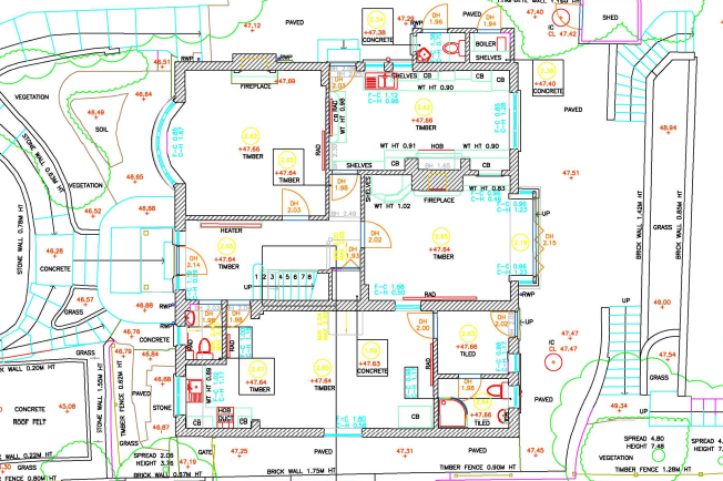
Floor and ceiling plans are created in AutoCAD from the collective point cloud file, enabling the technicians to draft accurate, true as-built information, no matter how ornate or complex the property is.
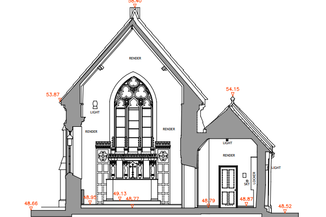
Elevations and sections are created by using both the constructed floor plans and point cloud file as reference, in order to maintain a consistent level of accuracy throughout.
A fully controlled site closed traverse is implemented on all large scale surveys, enabling the surveyors to work from 'the whole to the part' maintaining the survey accuracy is achieved. Smaller residential gardens are surveyed using Laser Scanners, to enable the house and gardens be presented as one point cloud.
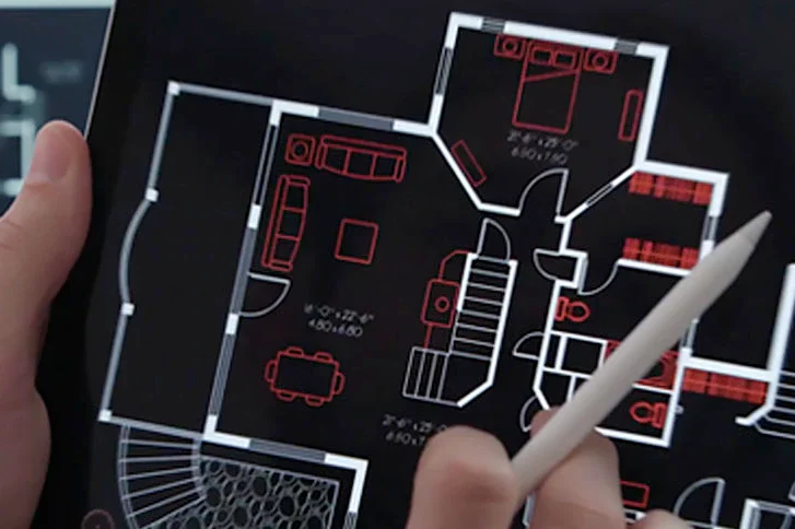
The level and accuracy of the drawings will be related to the agreed scale. These can range from 1:200 for larger plots, to 1:10 for ornate or detailed work.
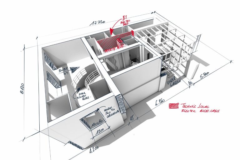
In addition to 2D plans, we can provide basic 3D or fully rendered 3D Models.
BIM is the process of managing the information created during initial design and throughout the construction of the project.
We have undertaken various Scan to Bim projects, varying in size and LOD - level of detail, ranging from small residential houses to larger multi storey buildings. The 3D BIM model is created and delivered in Revit.
Let's talk about your upcoming project..
Please complete the form to send us a message and we will respond to your enquiry within 48 hours.
Silverstream House,
45 Fitzroy Street, Fitzrovia
London W1T 6EB
Tel: 020 8154 5659
E-mail: info@footprintsurveys.com
© Copyright. All rights reserved.
We need your consent to load the translations
We use a third-party service to translate the website content that may collect data about your activity. Please review the details and accept the service to view the translations.